
LTA said the new map design will make the Circle Line the focal point for “quicker reading and journey planning”.
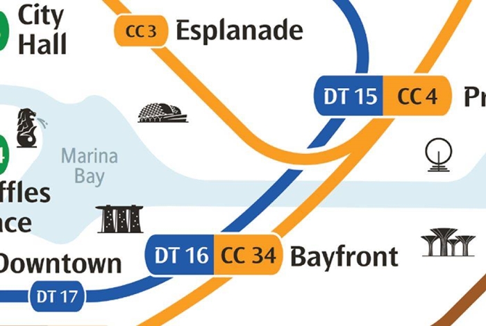
The Land Transport Authority (LTA) has unveiled a new MRT system map on Wednesday (Dec 11). Among the most notable changes is the redesign of the Circle Line, which now looks like an actual circle.
As the number of MRT stations and lines will increase over the years, the new map design will make the Circle Line the focal point for “quicker reading and journey planning”, said LTA.
“When viewing the new map, the Circle Line will intuitively serve as a focal point to help commuters quickly orientate themselves and plan their journeys,” LTA said, reported Channel News Asia.
And for the first time, the new map will have prominent landmarks such as Marina Bay, Merlion, Gardens by the Bay and the Esplanade to help commuters identify their corresponding station.
LTA said that the new map will be installed progressively at all MRT and LRT stations, starting with three stations on the soon-to-open Thomson-East Coast Line (TEL) – Woodlands North, Woodlands, Woodlands South. All other MRT and LRT stations will have the map installed from January next year.
QR codes will also be included on the map, which will allow users to calculate their fares via LTA’s online calculator. It will also contain downloadable maps in Singapore’s four official languages.
How will the MRT lines and public transport improvements affect the property market? Find out in our Property Market Outlook 2020 report.
New signage will be more user-friendly
Apart from the map redesign, LTA also said that MRT stations will come with new signage. They come with larger font, new and improved icons, sharper colour contrast and improved signbox design, making it easier for commuters to read and understand the information provided.
For example, exit signs will be in yellow to make them more notable, while alphabets will be replaced with numbers for universal understanding.
The Senior Parliamentary Secretary for Transport Baey Yam Keng said the soon-to-open TEL gave allowed LTA to improve station signage and revamp the MRT map.
“With an ageing population, we also want to encourage the elderly to make use of the train,” he told reporters at Woodlands South station.
“Larger font size, clearer symbols – all these make wayfinding a lot easier and convenient for commuters.”
Meanwhile, the enhanced signage installed at Woodlands North, Woodlands, Woodlands South on the TEL will undergo public feedback before LTA decides to install them in other stations.
The first stretch of the TEL will be operational by 31 January 2020. When completed in 2025, it will have 32 stations and seven interchange stations.
Looking for a property in Singapore? Visit PropertyGuru’s Listings, Project Reviews and Guides.
Victor Kang, Digital Content Specialist at PropertyGuru, edited this story. To contact him about this or other stories, email victorkang@propertyguru.com.sg


